Atmospheric Rivers Put an End to Late-Fall King Season

Guide Sam Stover of Brookings Fishing Charters holds a hefty Smith River king that was released Saturday after smacking a 5.0 MagLip.

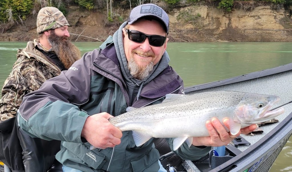
This week’s report will be mostly about water, because there’s a lot more water at the moment than fishing opportunities. In case you haven’t heard, the North Coast is smackdab in the middle of some severe storms that are taking aim at the coast with heavy winds and copious amounts of rain. Several rivers are forecast to exceed monitor and approach flood stage in the coming hours. These high flows will signal the end of the late fall salmon fishing season on the Eel and Smith rivers, and make available spawning habitat that wouldn’t normally be accessible in drier years. With both rivers seeing strong returns of kings, coupled with an abundance of prime spawning habitat, this really bodes well for the future.  While we kick the kings up the tributaries, we now begin to think about winter steelhead. November is typically a little early to see big numbers – but it won’t be long. My hunch is after a few more good storms over the next couple weeks, the uber popular winter steelhead run will be afoot.

Weather ahead
According to the Eureka’s National Weather Service, the atmospheric river storm system will continue to bring prolonged moderate to heavy rainfall tonight through Friday. “An additional 4 to 6 inches with isolated 8 inches is forecast Wednesday night through Friday, with the bulk falling Thursday through Thursday Night. After the passage of the secondary cyclone Thursday, most ensemble guidance shifts the parent trough westward on Friday, which would put Northwestern California in the cold sector and shut off our subtropical moisture tap, marking a change from persistent moderate rainfall to showery rainfall. Rain will likely continue during this period through the weekend, however be generally less, and with more sparse coverage.”

Sport crab trap restrictions stay put, delays for Commercial
In a press release issued Thursday, the California Department of Fish and Wildlife (CDFW) is continuing the temporary recreational crab trap restriction from the Sonoma/Mendocino county line to Lopez Point (Fishing Zones 3 and 4) due to presence of humpback whales and the potential for entanglement from trap gear. They also continued the delay for the recreational opener in the northern portion of Fishing Zone 1 (from the CA/OR border to the southern boundary of the Reading Rock State Marine Reserve) due to unhealthy levels of domoic acid.

“CDFW is continuing the Commercial Dungeness crab fishery delay in Fishing Zones 3-6 due to the presence of humpback whales and risk of entanglement. This delay is necessary due to the high number of entanglements that have occurred this year, four of which involved the commercial fishery. The delay will allow whales to continue their migration to winter breeding grounds and away from the fishing grounds, thereby reducing entanglement risk.  

Given the high abundance of whales and entanglements that have occurred this year, CDFW will assess entanglement risk again in early December. It is expected that the next risk assessment will take place on or before Dec. 5, 2024, at which time Director Bonham will re-evaluate the temporary recreational crab trap restrictions and statewide commercial fishery delay.” More information can be found here.

Mad River Steelhead Reward Program Returns for 2024-25
For the Mad River steelhead fishery in the upcoming 2024-25 season, the California Dept. of Fish and Wildlife (CDFW) will once again attach reward tags to a small subset of hatchery-origin (i.e., adipose-clipped) adult steelhead upon their return to freshwater. This is in effort to estimate the steelhead harvest on the Mad River. According to John Deibner-Hanson, a Northern Region Environmental Scientist for CDFW, a number of fish will be captured in the lower river using tangle nets and affixed with spaghetti tags worth $20, $50 or $100 rewards. Once the tags are applied on their backs behind the dorsal fin, the fish will be released.

Upon capturing a reward tag, anglers will need to follow one of the methods outlined below to answer a series of questions about how the tag was acquired (e.g., caught on fish, found on dead fish, found on bank). Anglers will have until April 15, 2025 to report tags and claim rewards, after which reward tags from this season will expire. To attain accurate harvest estimates, we must assume 100% tag return rates on harvested steelhead, so getting the word out for our tagging program will be vital to its success.

There are three ways an angler may report their tag for reward:

  1. Scan the QR code posted on message boards and signage around the river or carried by CDFW creelers
  2. Visit: https://forms.office.com/g/jjWnw9t7Ss
  3. Return the tag to CDFW at: 50 Ericson Ct., Arcata, CA

Using options 1 and 2 above, anglers will not submit the physical tag, only needing to provide the unique tag number and answering the accompanying questions online. For this reason, anglers are strongly urged to retain the tag after submittal until all rewards have been claimed, as only one reward will be paid for each uniquely numbered tag. For questions, please email MadRiverRewards@wildlife.ca.gov.

The Rivers:
As of Thursday, all North Coast rivers subjected to low-flow fishing closures were open to fishing. This includes the Mad, main stem Eel, South Fork Eel, Redwood Creek, Van Duzen and Smith rivers. The Department of Fish and Game will make the information available to the public by a telephone recorded message updated, as necessary, no later than 1 p.m. each Monday, Wednesday and Friday as to whether any stream will be closed to fishing. The rivers can be opened up at any time. The low flow closure hotline for North Coast rivers is 707-822-3164. NOTE: The main stem Eel from the South Fork to Cape Horn Dam, the Mad River from the mouth to 200 yards upstream and the Mattole River will be closed until January 1, 2025. More information can be found here.

Mad
The Mad is forecast to reach minor flood stage Friday morning, with flows expected to reach nearly 34,000 cfs. More rain is in the forecast next week, fishable conditions won’t be coming any time soon. Current river conditions: cdec.water.ca.gov/river/madStages.html

Main stem Eel
Flows were over 62,000 cfs Thursday and rising. It’s predicted to peak at over 252,000 cfs Friday afternoon, which surpasses action/monitor levels. It’s forecast to be down to 33,000 cfs by early next week, but with more rain it’s not going to drop into fishing shape in the near future. Current river conditions: cdec.water.ca.gov/river/eelStages.html

South Fork Eel
The South Fork was peaking Thursday morning at roughly 24,000 cfs, but that will be short-lived. With another four inches or rain in the forecast, it’s predicted to surpass action/monitor stage Friday morning, peaking at over 59,000 cfs. It will need a week of dry weather before it’s close to fishable. Current river conditions: cdec.water.ca.gov/river/eelStages.html

Van Duzen
Like the rest of the coastal rivers, the Van Duzen is predicted to surpass monitor stage. Flows Thursday morning were 16,000 cfs, with peak flows expected to reach 33,350 cfs early Friday morning. Current river conditions: cdec.water.ca.gov/river/eelStages.html

Smith
The Smith is likely the only river on the coast that is actually on the drop. Flows were just under 30,000 cfs Thursday, with the next rise forecast for Friday morning. It’s predicted to peak Friday at over 46,000 cfs Friday, and will be on the drop through the weekend. Depending on how much rain falls next week, it could drop into fishable shape at some point. The salmon run is likely done for the season and we should start to see a few early steelhead show up. Current river conditions: cdec.water.ca.gov/river/smithStages.html

Nov. 29 and 30 free fish days in Oregon
The Oregon Department of Fish and Wildlife is waiving all fishing licensing requirements on the Friday and Saturday after Thanksgiving to encourage people to experience fishing with friends and family during the long holiday weekend. All fishing, crabbing and clamming in Oregon will be free for both Oregon residents and non-residents. No licenses, tags or endorsements are needed on those days, but all other fishing regulations apply. Visit https://www.dfw.state.or.us/news/2024/11_Nov/111324.asp for more info.

Chetco/Elk/Sixes
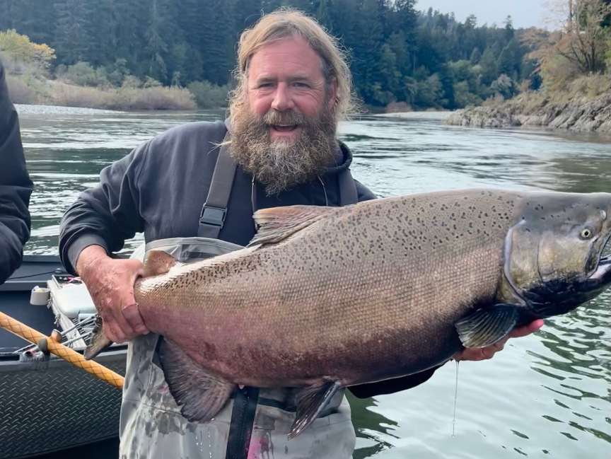
“Salmon fishing was decent on the Chetco and Elk, and good on the Sixes River before the latest series of storms,” said Andy Martin of Wild Rivers Fishing. “The Chetco will now likely be blown out until at least Thanksgiving Day, with a crest of more than 40,000 cfs expected. Snow fell at higher elevations before the big storm hit, so that could add to even more runoff. The average size of the kings on the Chetco, Elk and Sixes has been above recent averages. The first couple steelhead of the season also have been released on the lower Chetco.” 

Kenny Priest operates Fishing the North Coast, a fishing guide service out of Humboldt specializing in salmon and steelhead. Find it on Facebook, Instagram, YouTube and fishingthenorthcoast.com. For up-to-date fishing reports and North Coast river information, email kenny@fishingthenorthcoast.com.

Low-Flow River Information for the North Coast – 2024/2025


Low Flow River Closures begin Sept. 1 and run through April 30, 2025.
North Coast rivers that are regulated by low flow closures, including the Eel River, Mad River, Mattole River, Redwood Creek, Smith River and Van Duzen River will begin angling restrictions on September 1st, and run through April 30th 2025. . As a reminder, in 2022, a low-flow angling restriction was added to the section of the Eel River from the mouth to Fulmor Road (Eel estuary) at its paved junction with the south bank of the Eel River. When a low-flow closure occurs in this section of the Eel, it will be closed to hook-and-line fishing; other legal fishing methods are allowed during this timeframe. The Department of Fish and Game will make the information available to the public by a telephone recorded message updated, as necessary, no later than 1 p.m. each Monday, Wednesday and Friday as to whether any stream will be closed to fishing. The rivers can be opened up at anytime. Rivers will not automatically open to fishing once minimum flows are reached. The low flow closure hotline for North Coast rivers is (707) 822-3164. NOTE: The main stem Eel from the South Fork to Cape Horn Dam and the Mattole River will be closed until January 1, 2025.

Section of river that is open to fishing is the main stem Smith River from the mouth of Rowdy Creek to its mouth.

Areas subject to low flow closures:

Mad River: The main stem Mad River from the Hammond Trail Railroad Trestle to Cowan Creek. Minimum flow: 200 cfs at the gauging station at the Highway 299 bridge. The Mad River from the mouth to 200 yards upstream is closed until Jan. 1, 2025.

The main stem Eel River: New in 2022, a low-flow angling restriction was added to the section of the Eel River from the mouth to Fulmor Road at its paved junction with the south bank of the Eel River, Sept. 1 through April 30. The stream flow will be monitored as follows: Minimum Flow: 350 cubic feet per second at the gauging station near Scotia.

The South Fork of the Eel River: The South Fork of the Eel River downstream from Rattlesnake Creek and the Middle Fork Eel River downstream from the Bar Creek. Minimum flow: 340 cfs at the gauging station at Miranda.

Van Duzen River: The main stem Van Duzen River from its junction with the Eel River to the end of Golden Gate Drive near Bridgeville (approximately 4,000 feet upstream of Little Golden Gate Bridge. Minimum flow: 150 cfs at the gauging station near Grizzly Creek Redwoods State Park.

Mattole River: The main stem of the Mattole River from the mouth to Honeydew Creek. Minimum flow: 320 cfs at the gauging station at Petrolia.

Redwood Creek: The main stem of Redwood Creek from the mouth to its confluence with Bond Creek. Minimum flow: 300 cfs at the gauging station near the Highway 101 bridge.

Smith River: The main stem Smith River from the mouth of Rowdy Creek to its confluence with Patrick Creek; the South Fork Smith River from the mouth upstream approximately 1000 ft to the County Road (George Tyron) bridge and Craigs Creek to its confluence with Jones Creek; and the North Fork Smith River from the mouth to its confluence with Stony Creek. Minimum flow: 600 cfs at the Jedediah Smith State Park gauging station.

Low-Flow River Information for the North Coast – 2025/2026

Chris Hall, left, and Raj Desai with a late season steelhead taken on the South Fork Eel River earlier in March. Photo courtesy of Fishing the North Coast


Low Flow River Closures begin Sept. 1 and run through April 30, 2026.
North Coast rivers that are regulated by low flow closures, including the Eel River, Mad River, Mattole River, Redwood Creek, Smith River and Van Duzen River will begin angling restrictions on September 1st, and run through April 30th 2026. As a reminder, in 2022, a low-flow angling restriction was added to the section of the Eel River from the mouth to Fulmor Road (Eel estuary) at its paved junction with the south bank of the Eel River. When a low-flow closure occurs in this section of the Eel, it will be closed to hook-and-line fishing; other legal fishing methods are allowed during this timeframe.

The low flow closure hotline for North Coast rivers is no longer in service. You can now find river openings and closures in real time online at https://wildlife.ca.gov/Fishing/Inland/Low-Flow/North-Coast. The rivers can be opened up at anytime. Rivers will not automatically open to fishing once minimum flows are reached. NOTE: The main stem Eel from the South Fork to Cape Horn Dam, the Mad River from the mouth to 200 yards upstream and the Mattole River will be closed until January 1, 2026.

Section of river that is open to fishing is the main stem Smith River from the mouth of Rowdy Creek to its mouth.

Areas subject to low flow closures:

Mad River: The main stem Mad River from the Hammond Trail Railroad Trestle to Cowan Creek. Minimum flow: 200 cfs at the gauging station at the Highway 299 bridge. The Mad River from the mouth to 200 yards upstream is closed until Jan. 1, 2025.

The main stem Eel River: New in 2022, a low-flow angling restriction was added to the section of the Eel River from the mouth to Fulmor Road at its paved junction with the south bank of the Eel River, Sept. 1 through April 30. The stream flow will be monitored as follows: Minimum Flow: 350 cubic feet per second at the gauging station near Scotia.

The South Fork of the Eel River: The South Fork of the Eel River downstream from Rattlesnake Creek and the Middle Fork Eel River downstream from the Bar Creek. Minimum flow: 340 cfs at the gauging station at Miranda.

Van Duzen River: The main stem Van Duzen River from its junction with the Eel River to the end of Golden Gate Drive near Bridgeville (approximately 4,000 feet upstream of Little Golden Gate Bridge. Minimum flow: 150 cfs at the gauging station near Grizzly Creek Redwoods State Park.

Mattole River: The main stem of the Mattole River from the mouth to Honeydew Creek. Minimum flow: 320 cfs at the gauging station at Petrolia.

Redwood Creek: The main stem of Redwood Creek from the mouth to its confluence with Bond Creek. Minimum flow: 300 cfs at the gauging station near the Highway 101 bridge.

Smith River: The main stem Smith River from the mouth of Rowdy Creek to its confluence with Patrick Creek; the South Fork Smith River from the mouth upstream approximately 1000 ft to the County Road (George Tyron) bridge and Craigs Creek to its confluence with Jones Creek; and the North Fork Smith River from the mouth to its confluence with Stony Creek. Minimum flow: 600 cfs at the Jedediah Smith State Park gauging station.

Salmon stymied by shifting Klamath mouth

Image

Photo Caption: The Klamath River mouth, seen here from the overlook on the north side of the river, has been opening and closing since the weekend, making it difficult for salmon to enter the river. Large swells are predicted for the weekend and hopefully the mouth can blow wide-open allowing what’s left of the fall run to make their way upriver. (Photo courtesy of Sara Borok, Klamath River Environmental Scientist)

Fishing the North Coast
by Kenny Priest/For the Times-Standard

Low Flow closures on North Coast rivers start Tuesday

Along the lines of the ’80s TV commercial for Wendy’s where the old lady shouts, “Where’s the beef?” Klamath salmon anglers have been wondering, “Where’s the salmon?” In truth, no one really knows. What we do know is 11,538 have been harvested below the 101 bridge and another 1,009 have been caught by sport anglers above the bridge. Throw in approximately 54,000 fish that have been harvested by the Yurok tribe and what you’re left with is a lot of missing fish. Sure, there’s a few fish that have squirted through and are now entering tributaries like the Trinity, Shasta, and Scott rivers, but with an in-river return at well over 250,000 predicted, the numbers aren’t adding up. A big part of the problem has been the mouth of the river. Flowing to the south and running narrow and shallow, conditions have been less than ideal for huge pushes of fish to enter the river. And with last week’s storms and big tide swings, it went from bad to worse. Since the weekend, it’s been opening and closing and has created a lake that can be felt all the way to Blakes’ riffle. At the moment, very few fish are entering the lower river and guides are lucky to catch a few a day.

According to Sara Borok, an Environmental Scientist on the Klamath River, we’ve been down this road before. “Back in 2001 we also had a south mouth that hampered the fish coming into the river. “It blew open on September 21 and we had a huge surge of fish pour in,” Borok said. “Although there’s no way to know for sure, my guess it there are still quite a few fish in the ocean waiting for the right conditions to enter.” With big swells again predicted for the weekend, there’s a chance the mouth can finally blow out enough to allow the remaining kings to enter the system and start their journey upriver. Let’s hope so.

Weekend marine forecast
If you’re hoping to fish offshore this weekend, Saturday will be your best bet. South winds are forecasted 5 to 15 knots with swells to 8 feet at 11 seconds.  Sunday isn’t looking as good with south winds to 20 knots and waves out of the west to 14 feet at 14 seconds. For up-to-date weather forecasts, visit http://www.weather.gov/eureka/. You can also call the National Weather Service at (707) 443-7062 or the office on Woodley Island at (707) 443-6484.

HASA meeting
A general membership meeting will be held Oct. 2 at 7 p.m. in Scott McBain’s office at 980 7th Street in Arcata. According to Cliff Hart, President of HASA, discussions will include urgent issues related to Pacific Halibut. “All fisherman and fisherwomen from the North Coast are invited to come and give feedback. We NEED to hear from you. If you can’t make the meeting, please email your comments about the current Pacific Halibut situation and what options you would like to see to: hasa6191@gmail.com. We are in an unfortunate situation where we will lose some halibut fishing. We don’t like any of the options dealt, but we have the ability to recommend. Public comment is open with PFMC, and we may call upon you to write letters and emails.” Hart added. The due date is 10/9/13. For more information, visit http://www.dfg.ca.gov/marine/pacifichalibut.asp

The Oceans:

Eureka
According to Tim Klassen of Reel Steel Sport Fishing, the rough ocean we’ve had this week has kept the boats off the water. “The last fishable day was Sunday and we were able to run to the Cape for Rockfish. Since then, nobody’s been out. Friday and Saturday are looking fishable, but it’s coming back up again on Sunday. Hopefully we’ll be able to go one of those days and drift for halibut as the bite has been pretty good. Last Thursday we were able to limit out our four customers” Klassen said.

Crescent City
Little if any angling is happing offshore out of Crescent City reports Chris Hegne’s of Englund Marine. “We’ve had some pretty rough seas this week and no one’s been out. The weekend isn’t looking much better,” Hegnes added.

Low Flow River Closures begin Oct. 1
North Coast rivers that are regulated by low flow closures, including the Eel River, Mad River, Mattole River, Redwood Creek, Smith River and Van Duzen River will begin angling restrictions on October 1st, except for the Mad River, which went into effect September 1st. The Department of Fish and Game will make the information available to the public by a telephone recorded message updated, as necessary, no later than 1 p.m. each Monday, Wednesday and Friday as to whether any stream will be closed to fishing. The rivers can be opened up at anytime. The low flow closure hotline for North Coast rivers is (707) 822-3164. NOTE: The main stem Eel from the South Fork to Cape Horn Dam and the Mattole River will be closed until January 1, 2014

Areas subject to low flow closures:

Mad River: The main stem Mad River from the Hammond Trail Railroad Trestle to Cowan Creek. Minimum flow: 200 cfs at the gauging station at the Highway 299 bridge.

The main stem Eel River from the paved junction of Fulmor Road with the Eel River to the South Fork Eel River. Minimum flow: 350 cfs at the gauging station near Scotia.

The South Fork of the Eel River downstream from Rattlesnake Creek and the Middle Fork Eel River downstream from the Bar Creek. Minimum flow: 340 cfs at the gauging station at Miranda.

Van Duzen River: The main stem Van Duzen River from its junction with the Eel River to the end of Golden Gate Drive near Bridgeville (approximately 4,000 feet upstream of Little Golden Gate Bridge. Minimum flow: 150 cfs at the gauging station near Grizzly Creek Redwoods State Park.

Mattole River: The main stem of the Mattole River from the mouth to Honeydew Creek.

Minimum flow: 320 cfs at the gauging station at Petrolia.

Redwood Creek: The main stem of Redwood Creek from the mouth to its confluence with Bond Creek. Minimum flow: 300 cfs at the gauging station near the Highway 101 bridge.

Smith River: The main stem Smith River from the mouth of Rowdy Creek to its confluence with Patrick Creek; the South Fork Smith River from the mouth upstream approximately 1000 ft to the County Road (George Tyron) bridge and Craigs Creek to its confluence with Jones Creek; and the North Fork Smith River from the mouth to its confluence with Stony Creek. Minimum flow: 600 cfs at the Jedediah Smith State Park gauging station.

The Rivers:

Lower Klamath
According to Mike Coopman of Mike Coopman’s Guide Service, with the mouth opening and closing since the weekend, very few fish are coming in. The big swells aren’t helping much either,” Coopman said.

Alan Borges of Alan’s Guide Service, who’s also working the lower river, reports guides are still struggling to catch fish in any numbers. “The ones we are catching are fresh with sea lice. Hopefully the ocean calms a bit and we can truly see if there are any good numbers of fish left to come in,” Borges added.

Lower Trinity
Curt Wilson of Curt Wilson Fishing Guides reports the rain and fluctuating flows brought a good amount of fish up the Trinity early this week. “The last few days, steelhead have taken over the show around the Willow Creek area. It seems as we are finally seeing the lack of kings we have been hearing about down low really catch up with us. Hopefully a few more decide to show up. The Willow Creek weir counted 140 fish on Tuesday, but most of them were steelhead,” Wilson added.

Find “Fishing the North Coast” on Facebook for up-to-date fishing reports and North Coast river information. Questions, comments and photos can be emailed to kenny@fishingthenorthcoast.com.